یک سری نقشه های ایران را می توانید در زیر با کلیک کردن بر روی هر نقشه، آنرا دانلود کنید:
Country Maps
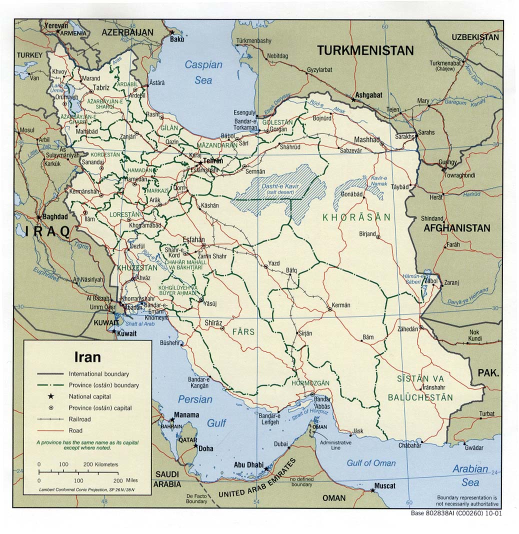
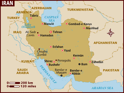
Iran (Political) 2001 (247K) and pdf format (263K
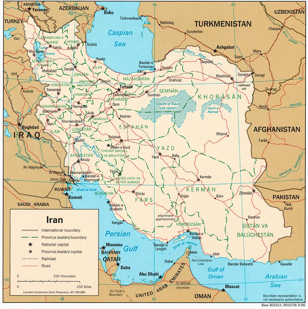
Iran (Political) 1996 (262K) and pdf format (271K
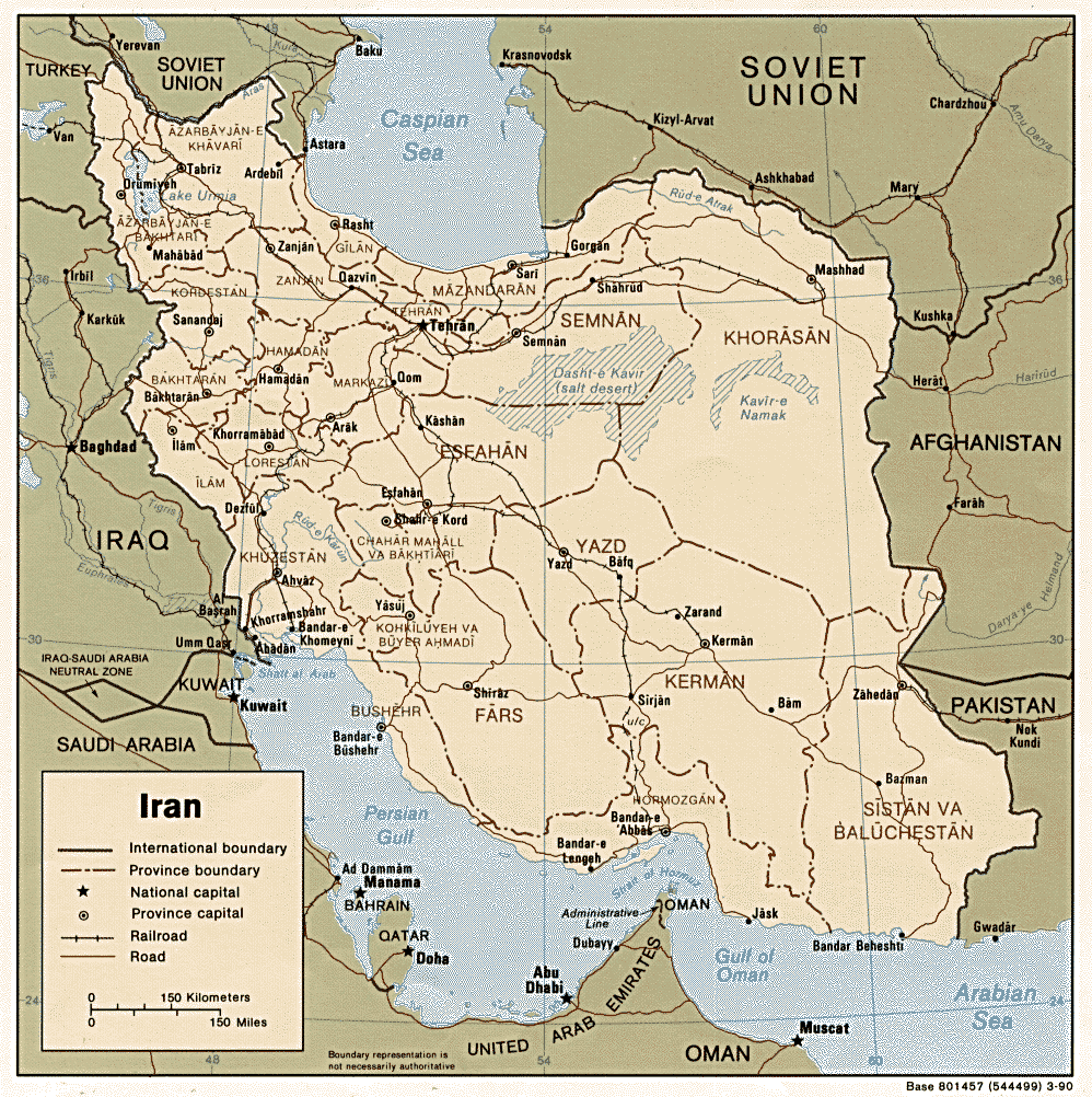
Iran (Political) 1990 (306K) and pdf format (317k
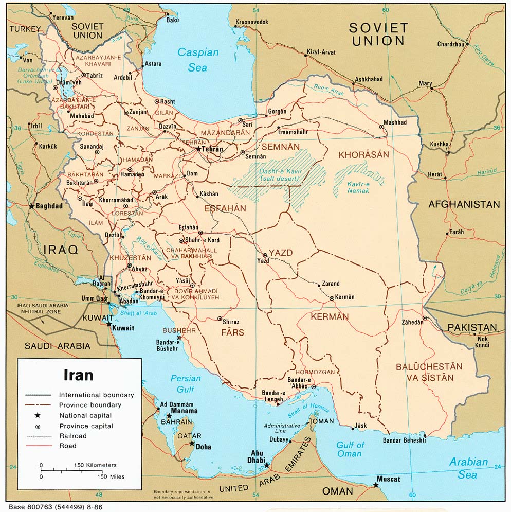
Iran (Political) 1986 (228K) and pdf format (236K
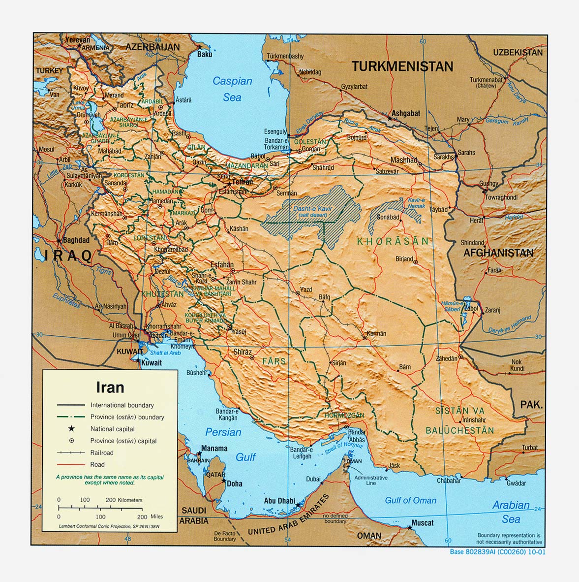
Iran (Shaded Relief) 2001 (321K) and pdf format (294K
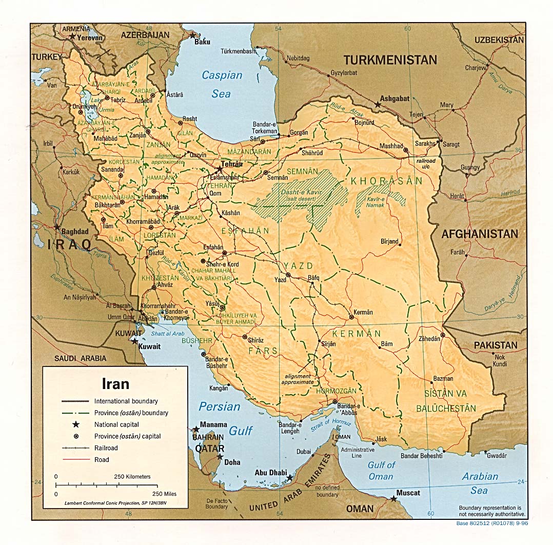
Iran (Shaded Relief) 1996 (312K) and pdf format (292K
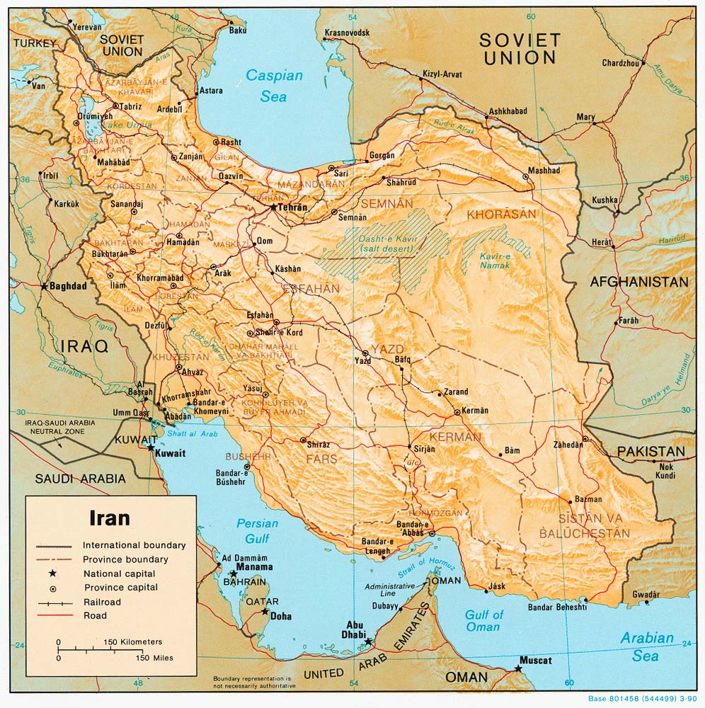
Iran (Shaded Relief) 1990 (277K) and pdf format (283K
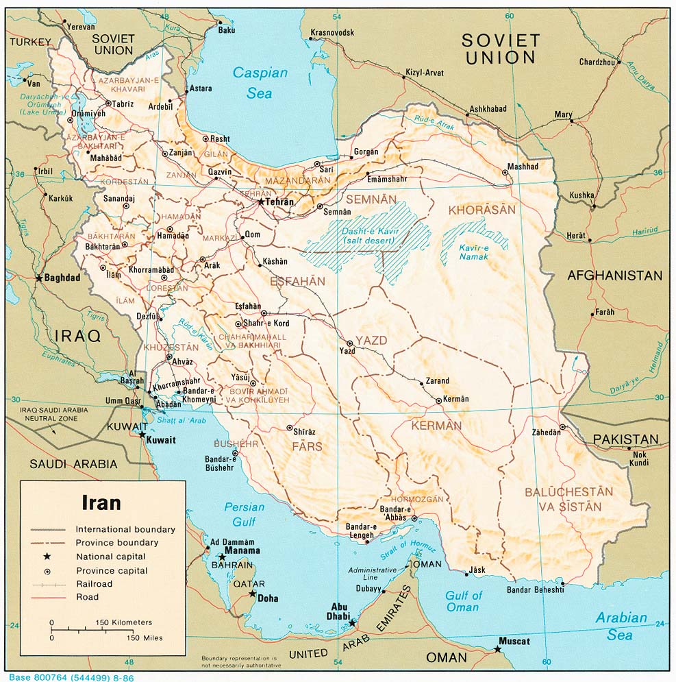
Iran (Shaded Relief) 1986 (235K) and pdf format (246K
Iran (Shaded Relief) 1982 (239K) and pdf format (247K
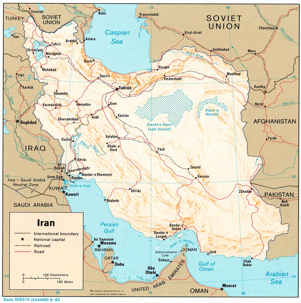
Iran (Shaded Relief) 1973 (398K) and pdf format (410K
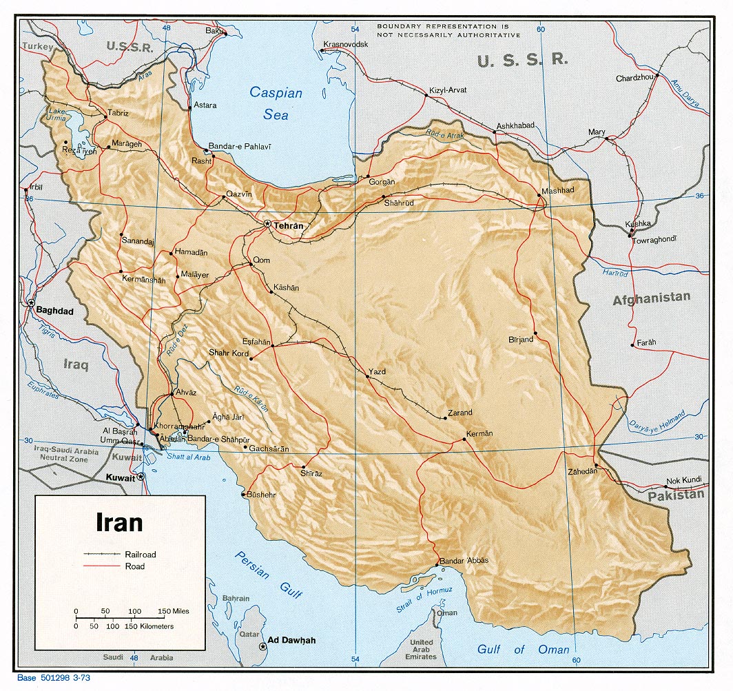
Iran (Small Map) 2008 (17K
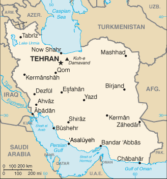
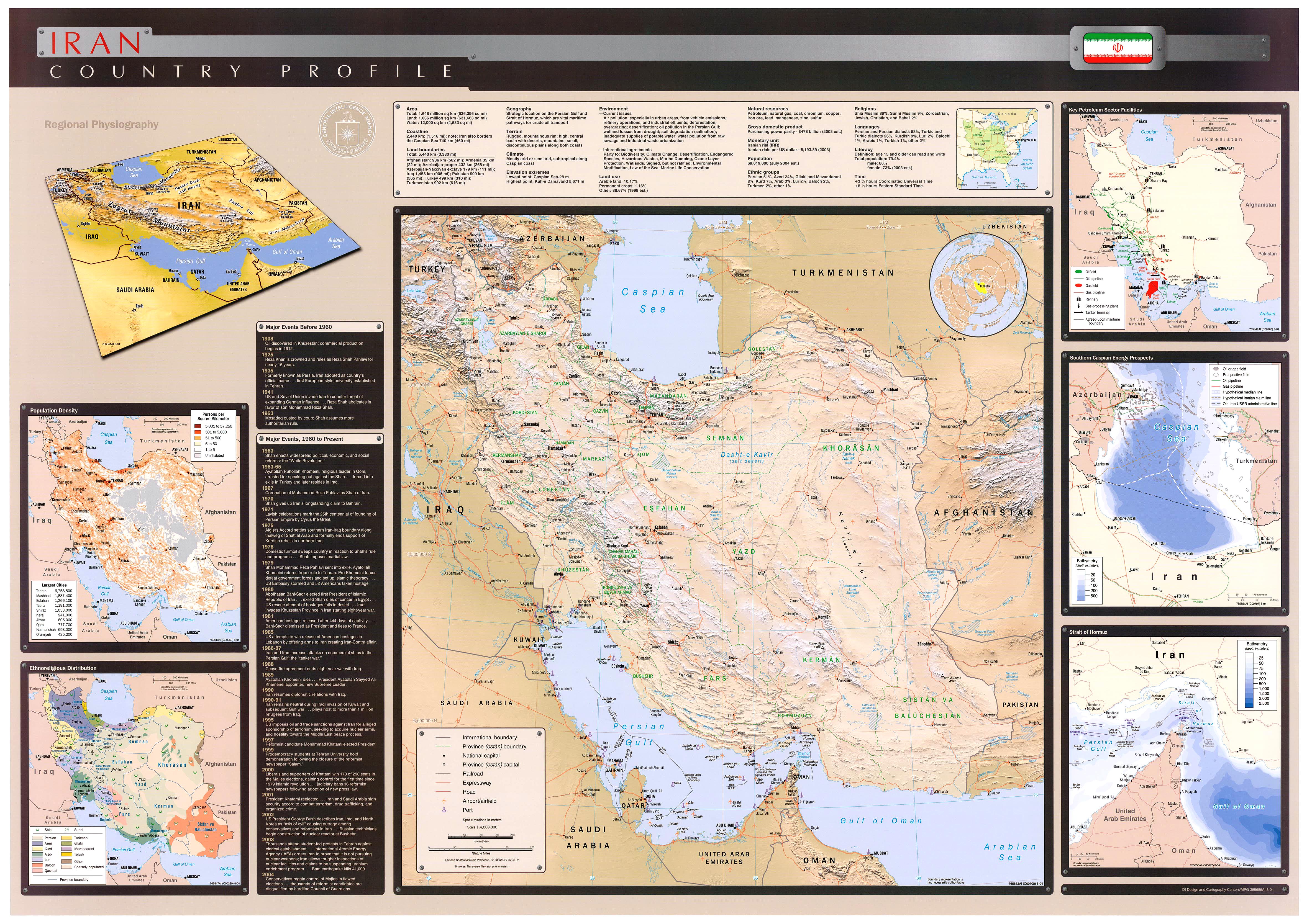
Iran (Wall Map) 2004 "Iran Country Profile" (2.5M
City Maps
Mashhad - East (446K) and Mashhad - West (764K)
(topographic maps in Russian) original scale 1:10,000 Portions of Soviet General Staff maps J-40-144 1 and 2 1971
Yazd (topographic map in Russian) original scale 1:25,000 Portion of Soviet General 1978 (1MB)
Detailed Maps
U.S. National Imagery and Mapping Agency. Earlier sheets were produced by the U.S. Defense Mapping Agency
Iran - Operational Navigation Charts, 1:1,000,000 [Not for Navigational Use]see Index Map
- ONC G-4 includes far northwest Iran. Edition 15, 8 January 1997, National Imagery and Mapping Agency (17.1 MB)
- ONC G-5 includes most of northern Iran. Edition 11, 4 February 1997, National Imagery and Mapping Agency (18.8 MB)
- ONC G-6 includes far northeast Iran. Edition 7, 19 November 1982, Defense Mapping Agency (11.8 MB)
- ONC H-6 includes southwest Iran. Edition 4, 21 November 1973, Defense Mapping Agency Aerospace Center (17.2 MB)
- ONC H-7 includes southeast Iran. Edition 11, 12 December 1994, Defense Mapping Agency Aerospace Center (17.5 MB)
- بقیه نقشه ها را در ادامه مطلب ببینید
- Middle East Maps
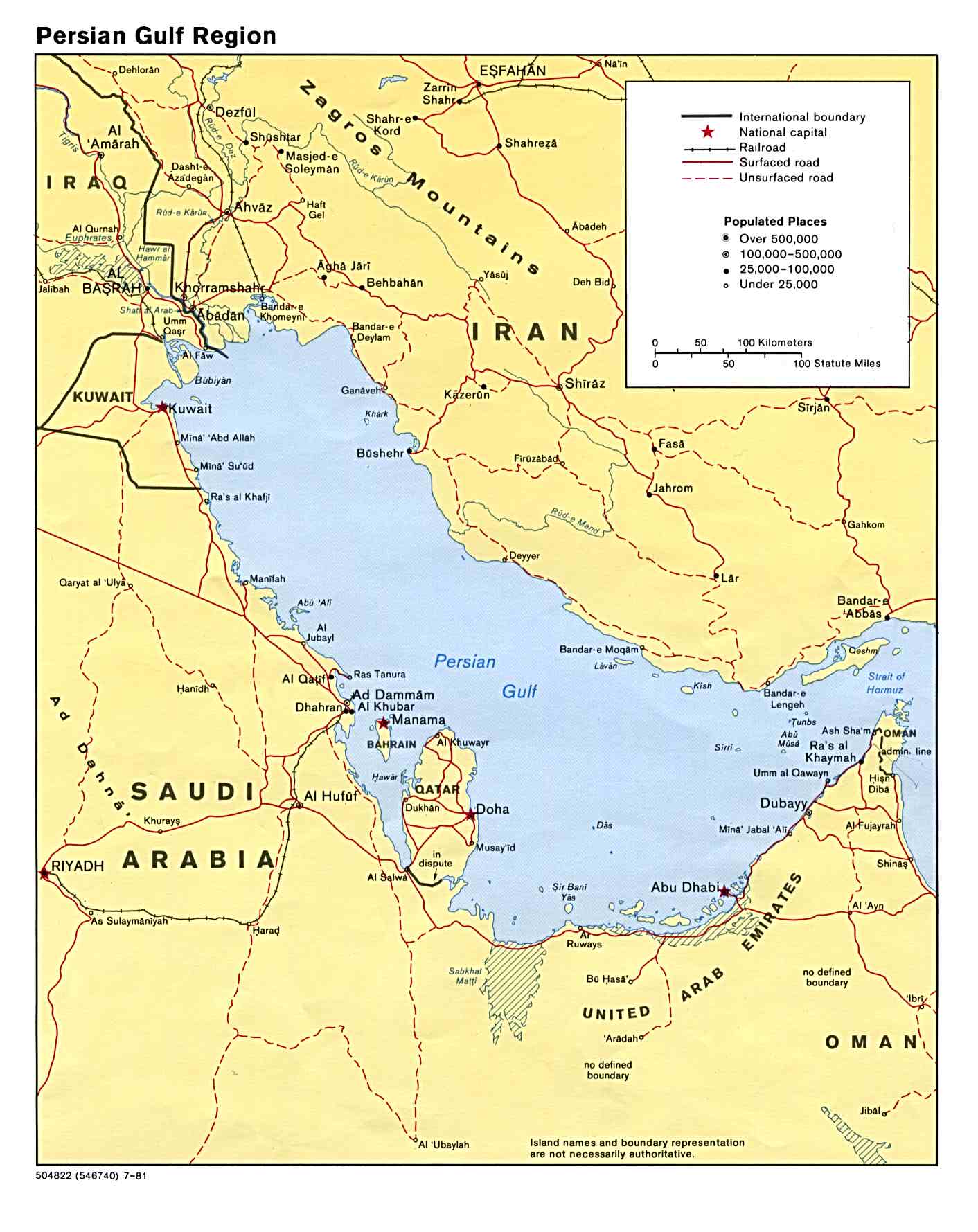
- Persian Gulf Region (Political) 1981 (187K
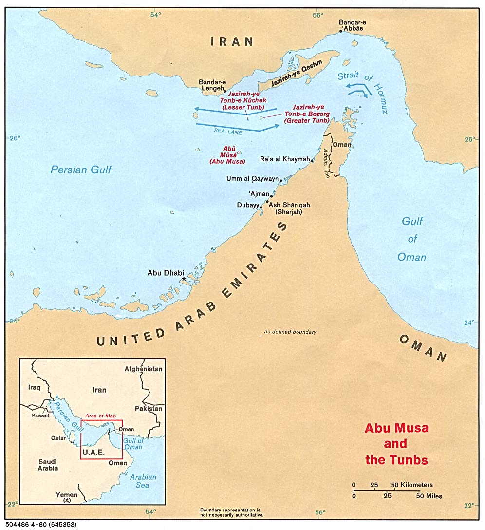
- Strait of Hormuz (Political) 1980 (149K
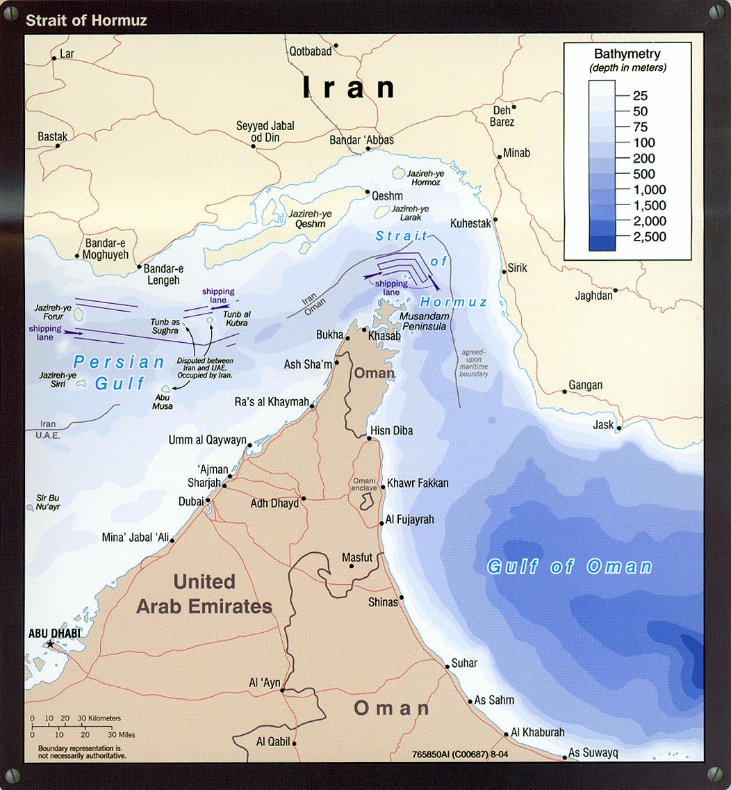
- Strait of Hormuz portion of Iran Country Profile 2004 (311K
- Caspian Region Oil Pipelines (633K) April 2002 [pdf format
- [Caspian Region] Oil and Gas Infrastructure in the Caspian Sea Region 2001 (2.5 MB
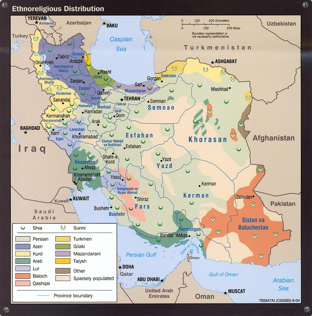
- Ethnoreligious Distribution portion of Iran Country Profile 2004 (373K
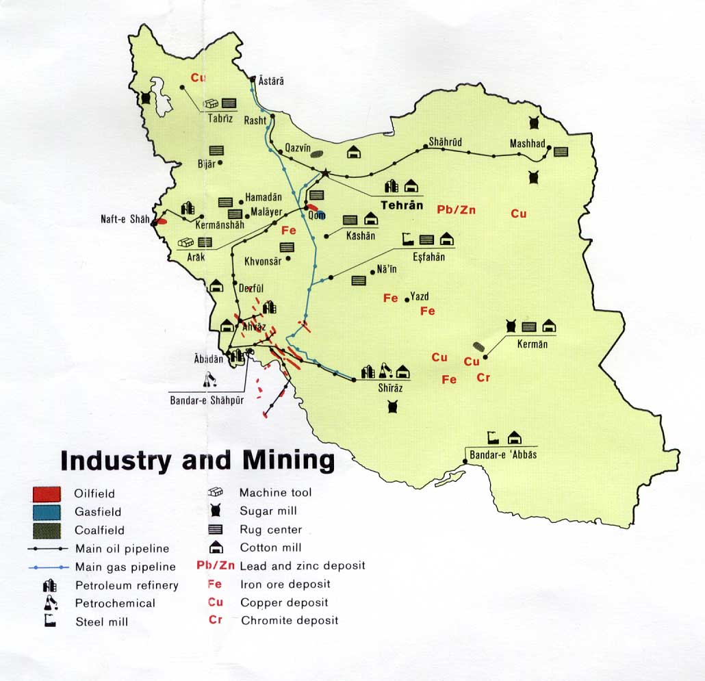
- Industry and Mining from U.S. Central Intelligence Agency map of Iran 1978 (108K
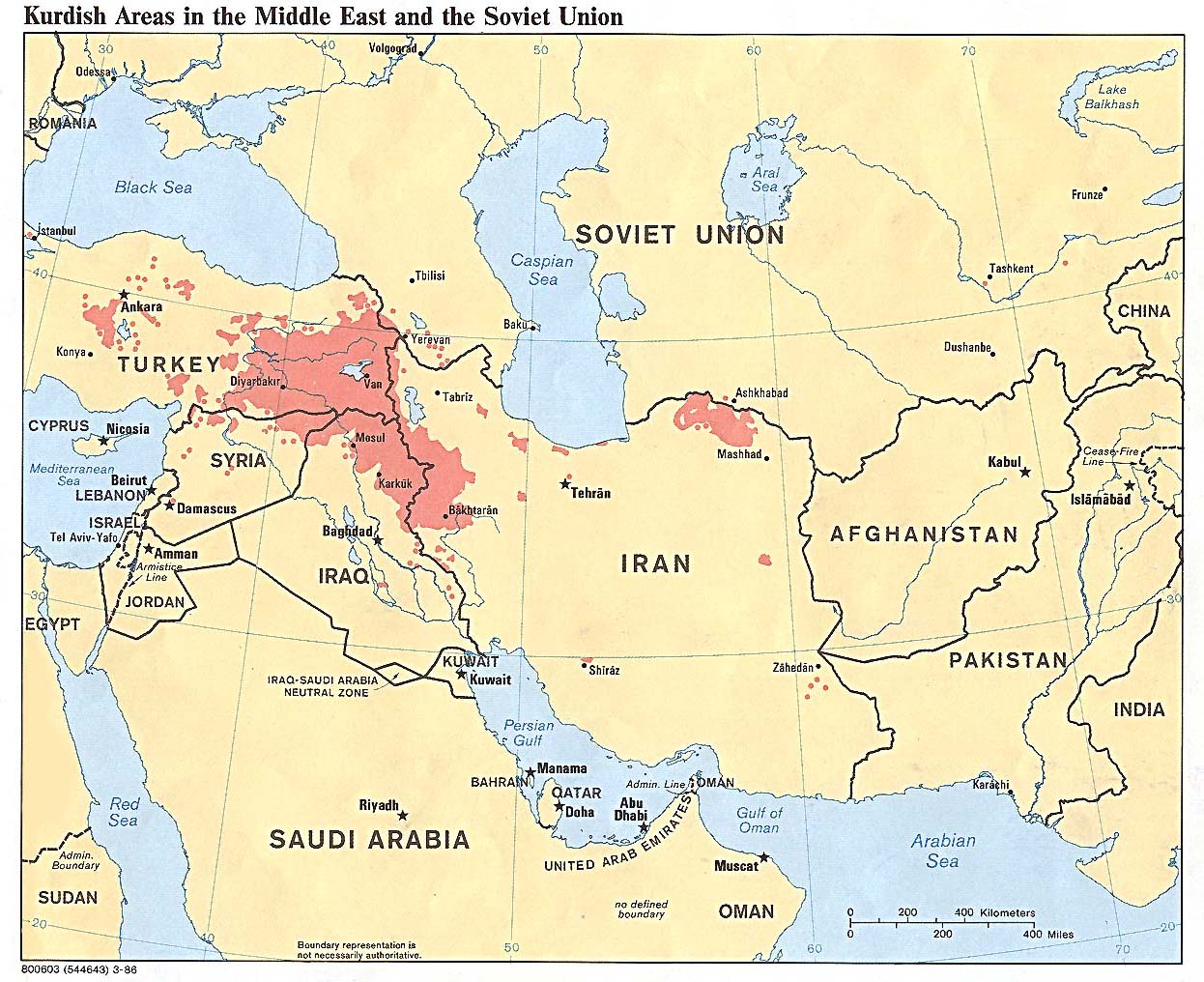
- Kurdish Areas in the Middle East and the Soviet Union 1986 (254K
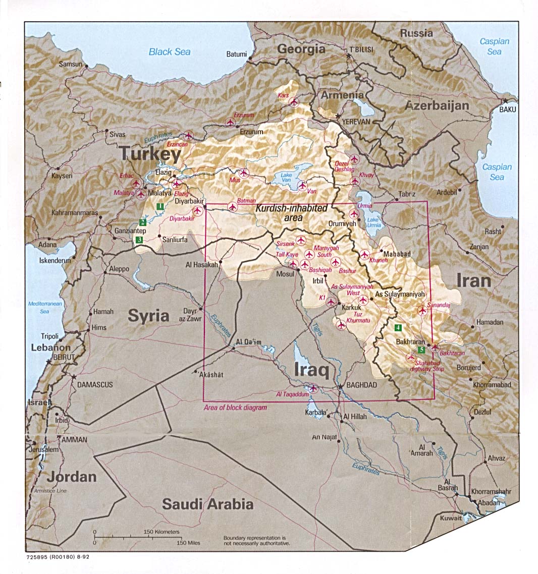
- Kurdish Lands (location map) 1992 (235K
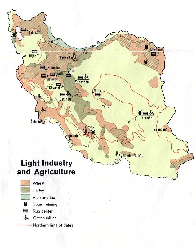
- Light Industry and Agriculture from U.S. Central Intelligence Agency map of Iran 1973 (84K
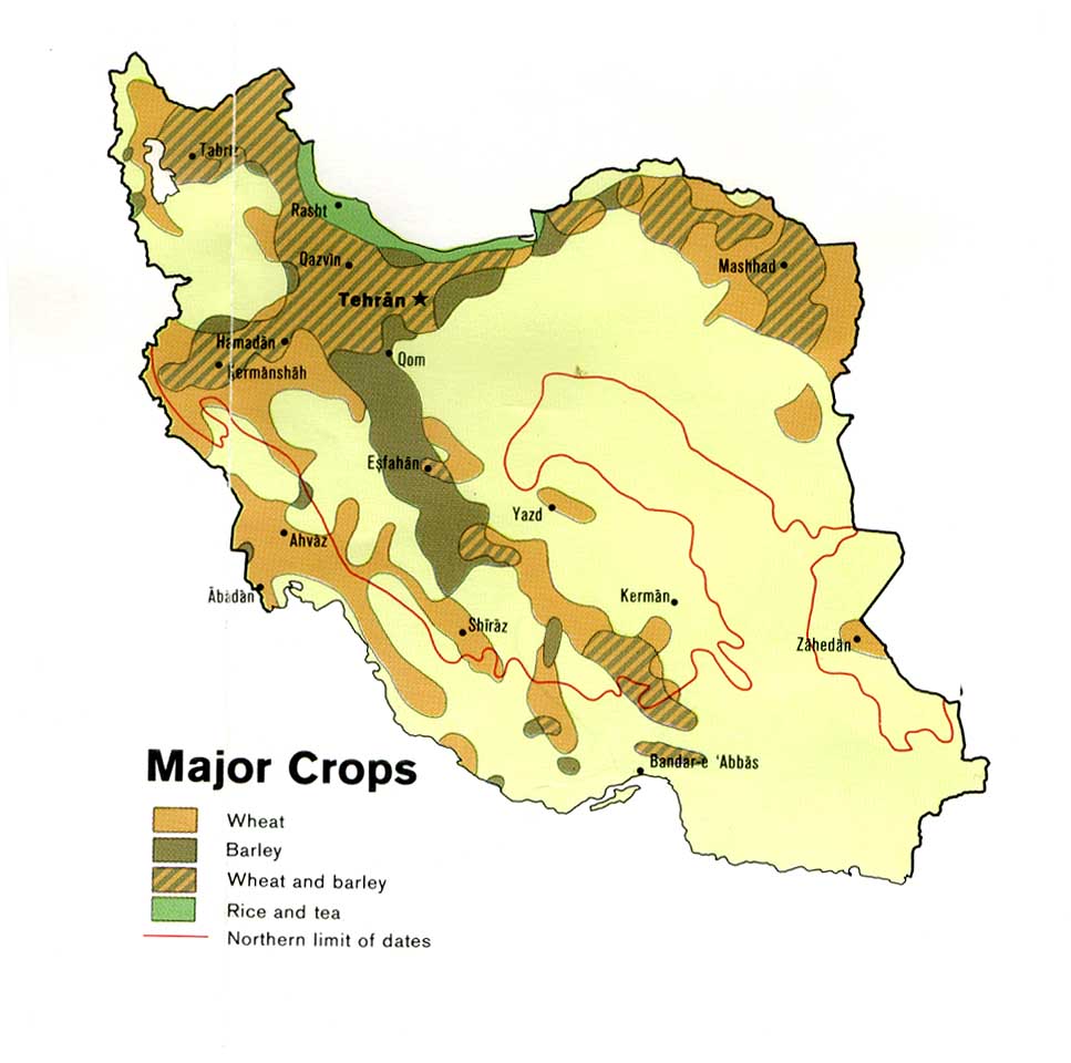
- Major Crops from U.S. Central Intelligence Agency map of Iran 1978 (96K
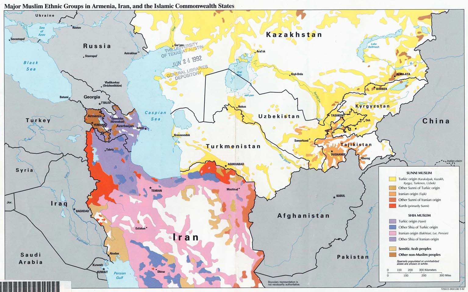
- Major Muslim Ethnic Groups in Armenia, Iran, and the Islamic Commonwealth States1992 203K
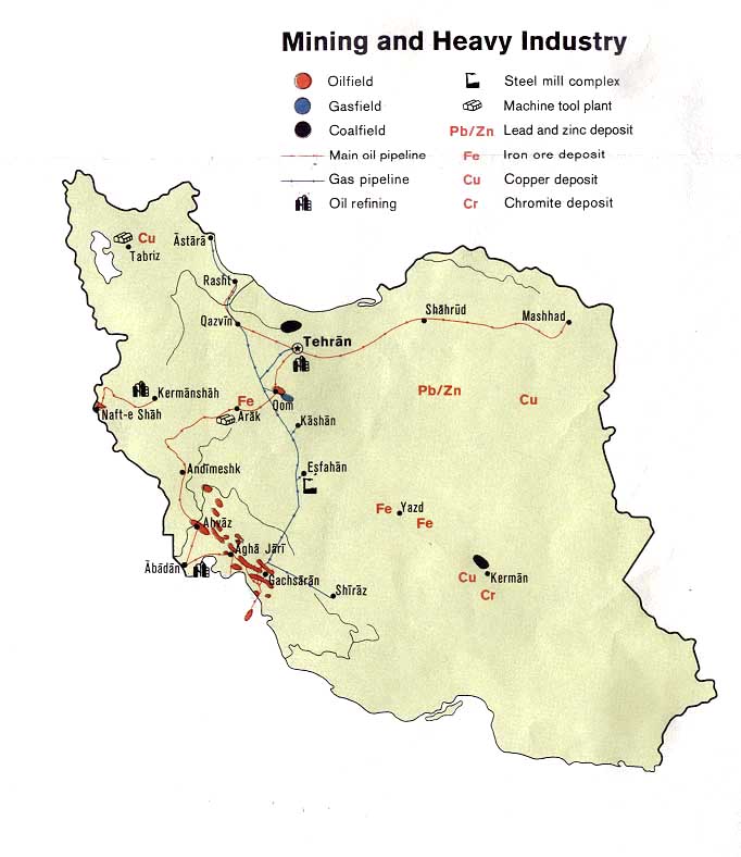
- Mining and Heavy Industry from U.S. Central Intelligence Agency map of Iran 1973 (80K
- Peoples of Iran [Ethnolinguistic Groups] 1982 (490K
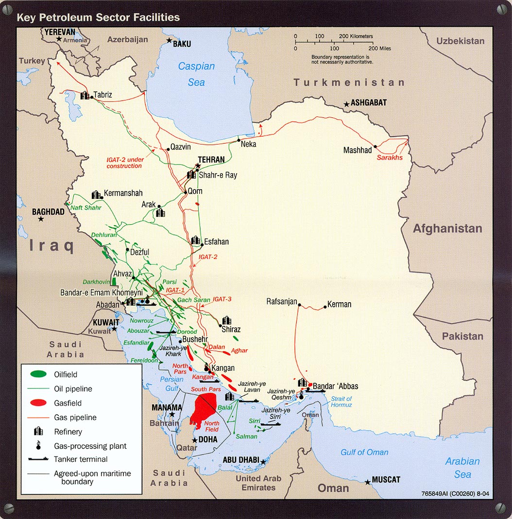
- Petroleum - Key Petroleum Sector Facilites portion of Iran Country Profile 2004 (318K
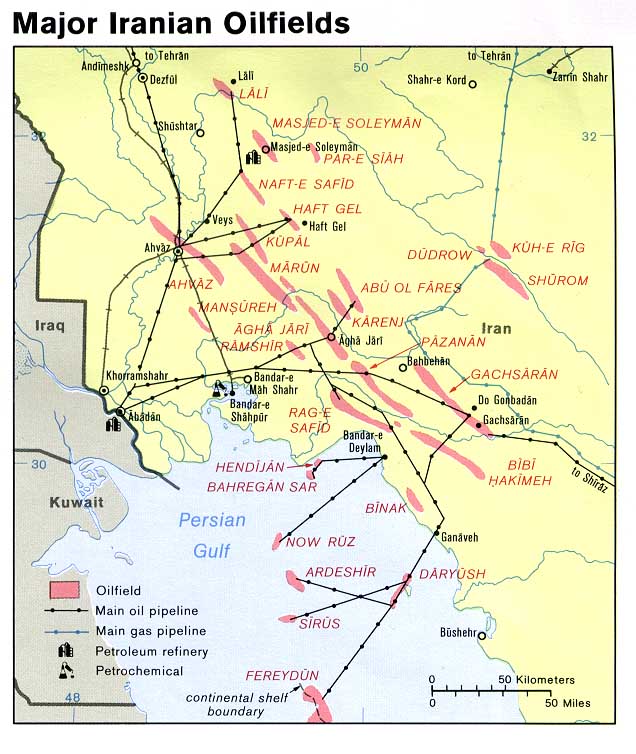
- Petroleum - Major Iranian Oilfields from U.S. Central Intelligence Agency map of Iran 1978 108K
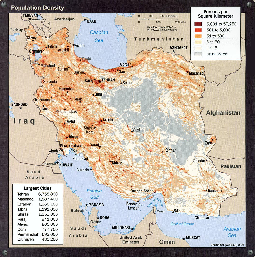
- Population Density portion of Iran Country Profile 2004 (413K
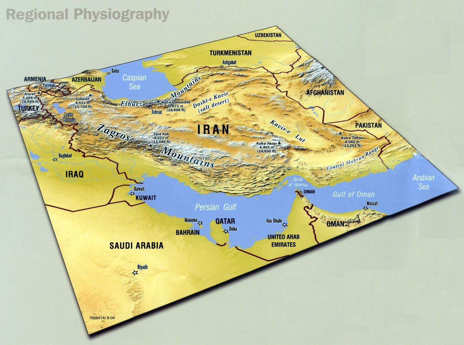
- Regional Physiography portion of Iran Country Profile 2004 (285K
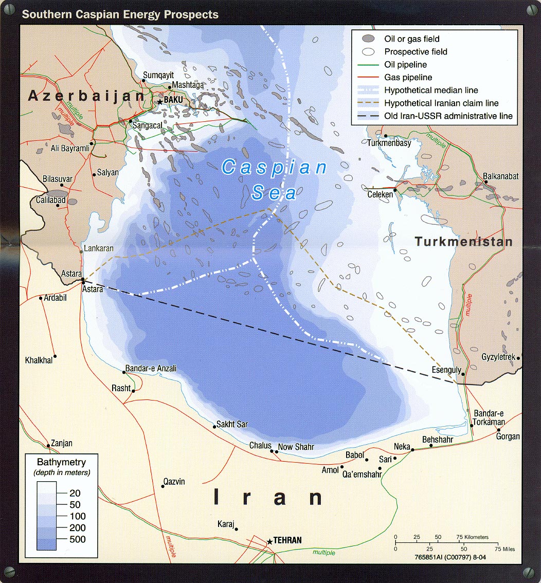
- Southern Caspian Energy Prospects portion of Iran Country Profile 2004 (394K
- Strait of Hormuz portion of Iran Country Profile 2004 (311K
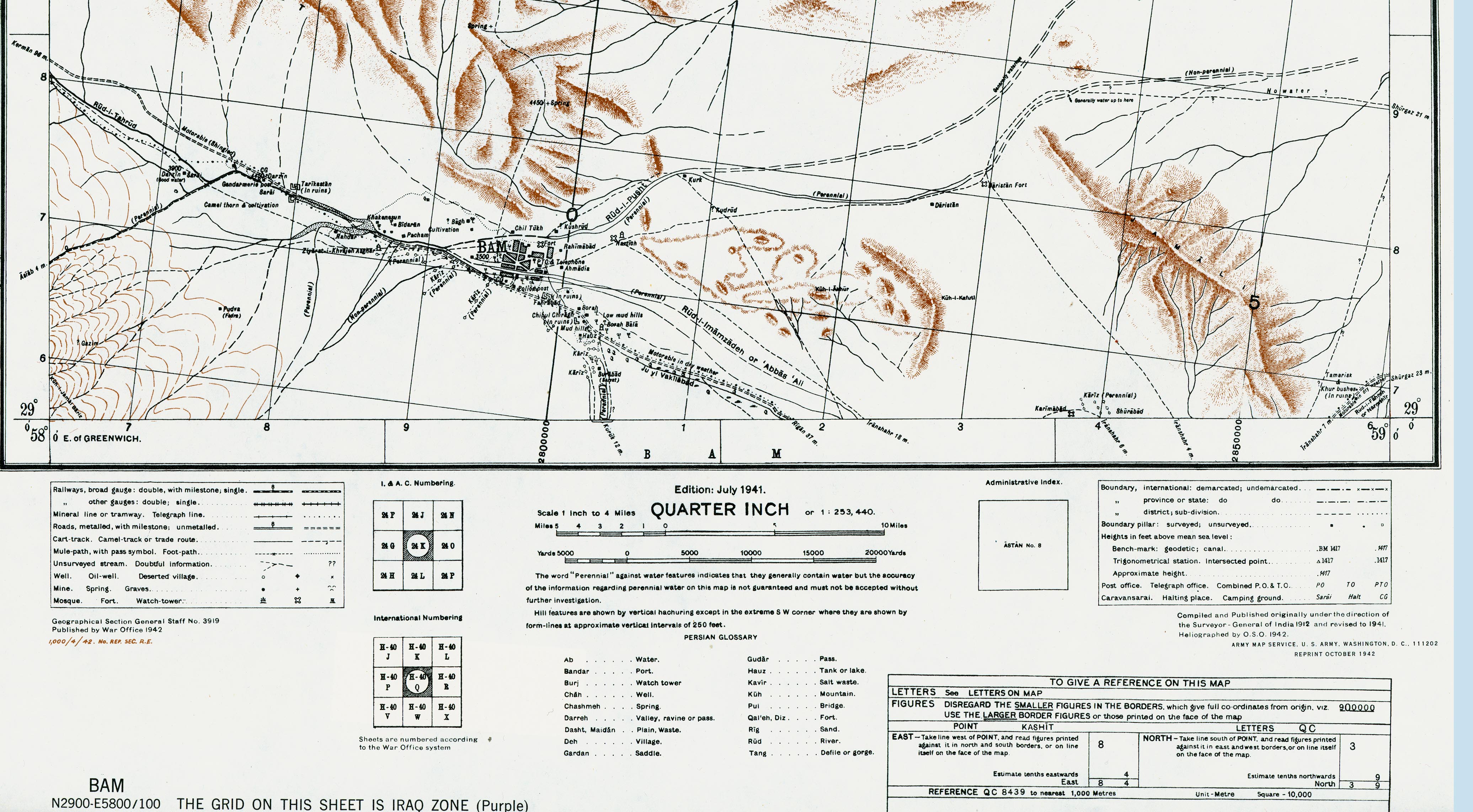
- Bam Area (1,520K
- Portion of sheet H-40 Q Bam. Edition July 1941. Original scale 1:253,440 Compiled and Published originally under the direction of the Surveyor-General of India 1912 and revised to 1941. Published by the War Office, 1942 and reprinted by the U.S. Army Map Service October 1942
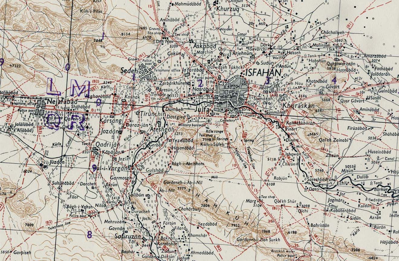
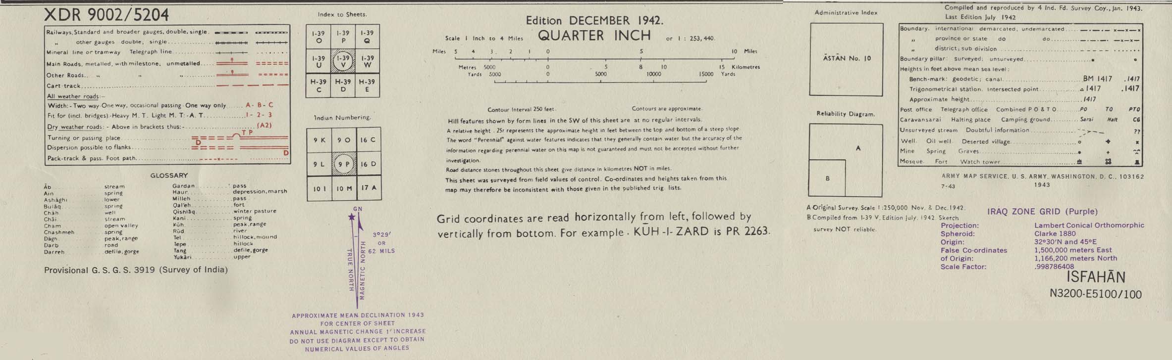
- Isfahan Area 1942 (314K) map key and scale (168K
- Portion of sheet I-39 V Isfahan. Edition December 1942. Original scale 1:253,440 Compiled and Reproduced by India Field Survey Company, January 1943. Published by the U.S. Army Map Service, July 1943
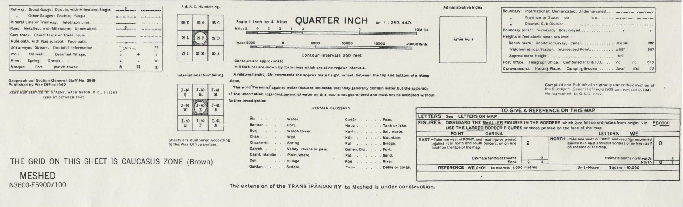
- Meshed [Mashhad] Area 1942 (538K) map key and scale (146K
- Portion of sheet J-40 X Iran. Original scale 1:253,440 Compiled and published originally under the direction of the Surveyor-General of India 1909 and Revised to 1941. Published by the War Office, 1942 and reprinted by the U.S. Army Map Service October 1942
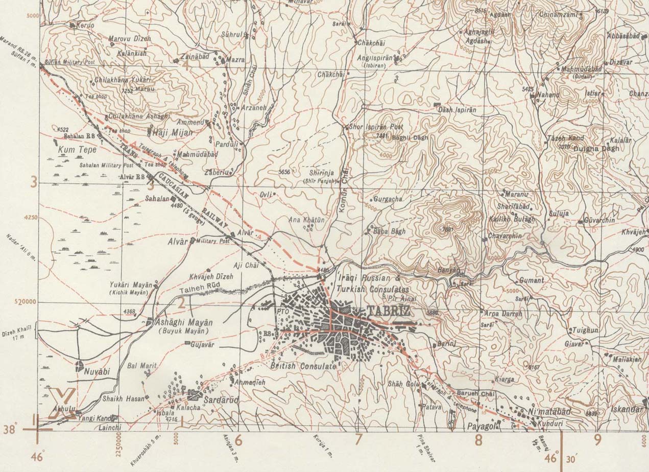
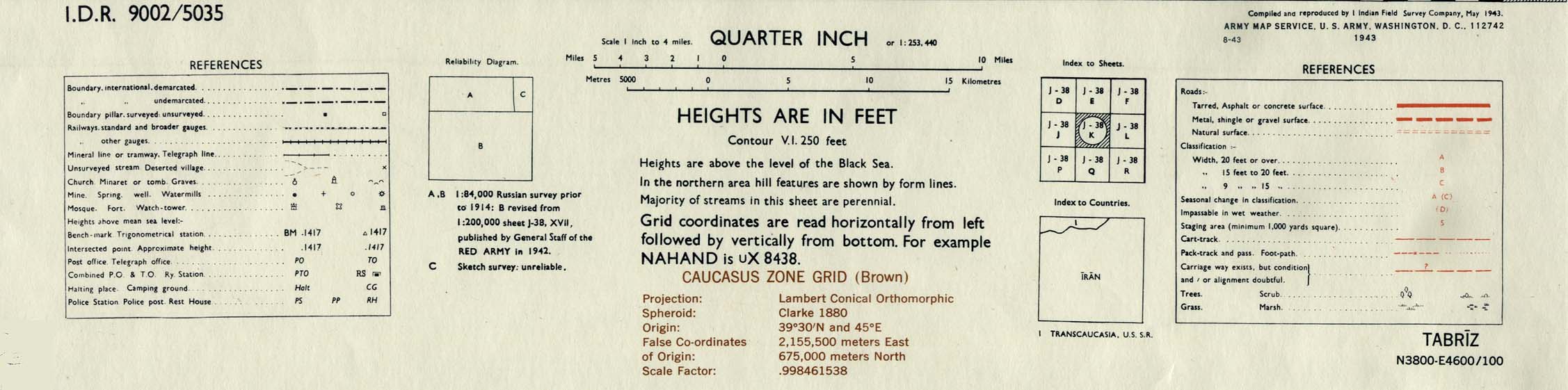
- Tabriz Area 1943 (244K) map key and scale (149K
- Portion of sheet J-38 K Tabriz. Original scale 1:253,440 Compiled and Reproduced by India Field Survey Company, May 1943. Published by the U.S. Army Map Service, August 1943
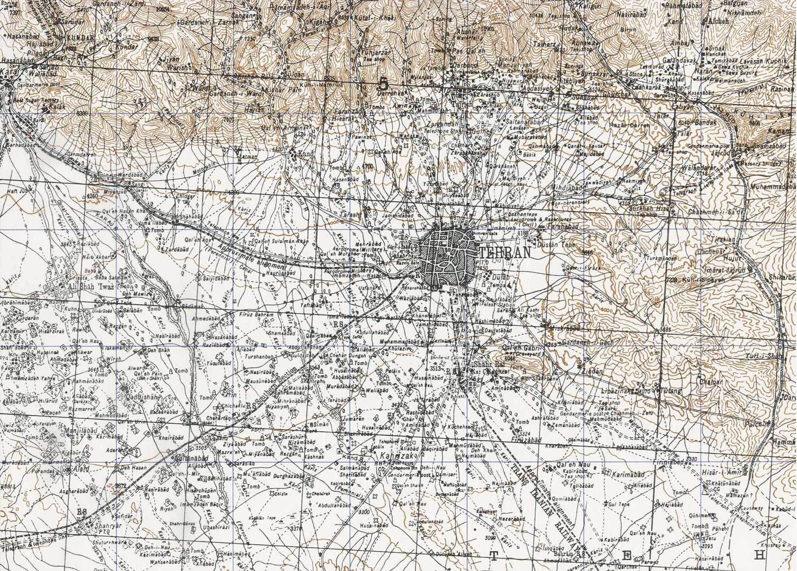
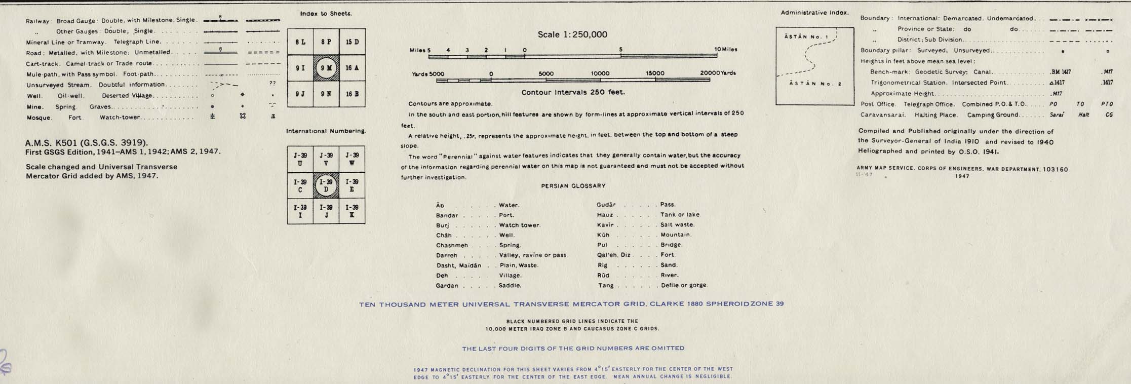
- Tehran Area 1947 (538K) map key and scale (146K)
- Portion of sheet I-39 D Iran. Original scale 1:250,000 Compiled and published originally under the direction of the Surveyor-General of India 1910 and Revised to 1940. Published by the U.S. Army Map Service November, 1947
- Iran (8 maps and charts) Published by the CIA January, 1993
- Iran (Persia.org
- Iran (Lonely Planet
- Iran (United Nations) [pdf format
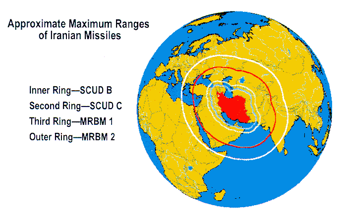
- Iran - Iranian Missiles, Ranges (Federation of American Scientists
- Iran in Maps (BBC News
- Iran - Maps (UNOSAT
- Iran - Natanz Uranium Enrichment Complex (ISIS
- Iran - Nuclear Facilities Maps (NTI
- Iran - Nuclear Sites (BBC News
- Iran - Provinces (Iransaga
- Iran - Railway Maps (IRIRW/Internet Archive
- Iran - Railways (MSEDV
- Iran - Railways Clickable Map (Raja
- Iran - Special Weapons Facilities Maps (Federation of American Scientists
- Iran - Special Weapons Facilities (GlobalSecurity.org
- Bam(Federation of American Scientists
- Esfahan/Isfahan (Iran Traveling Center
- Esfahan (Lonely Planet
- Mashhad (Mashhad Tourism
- Mashhad - Satellite Image (Google Maps
- Shiraz (Lonely Planet
- Shiraz (Shirazcity.org
- Shiraz [English] (Shirazcity.org
- Tabriz (Anobanini
- Tehran (Iran Traveling Center
- Tehran (Lonely Planet
- Tehran(Tehranshake
- Tehran - Clickable Map in English (Sahneh
- Tehran - Map in Persian and English (Iranmap) [PDF
- Tehran - Metro System
Regional Maps
Thematic Maps
![[Caspian Region] Oil and Gas Infrastructure in the Caspian Sea Region](http://www.lib.utexas.edu/maps/middle_east_and_asia/caspian_sea_oil_gas-2001.jpg)
![Peoples of Iran [Ethnolinguistic Groups]](http://www.lib.utexas.edu/maps/middle_east_and_asia/iran_peoples_82.jpg)
Historical Maps
![Meshed [Mashhad] Area 1942](http://www.lib.utexas.edu/maps/historical/meshed_iran_1942.jpg)
CIA Atlas of the Middle East
Maps on Other Web Sites
City Maps